

(ANGOLA) - Just days after powerful storms produced widespread damage, lengthy power outages and a confirmed tornado in the Angola area, forecasters are tracking another round of potentially severe weather for northeast Indiana and southern Michigan.
The first chance for severe weather arrives Tuesday afternoon and evening as a weak cold front moves through the region.
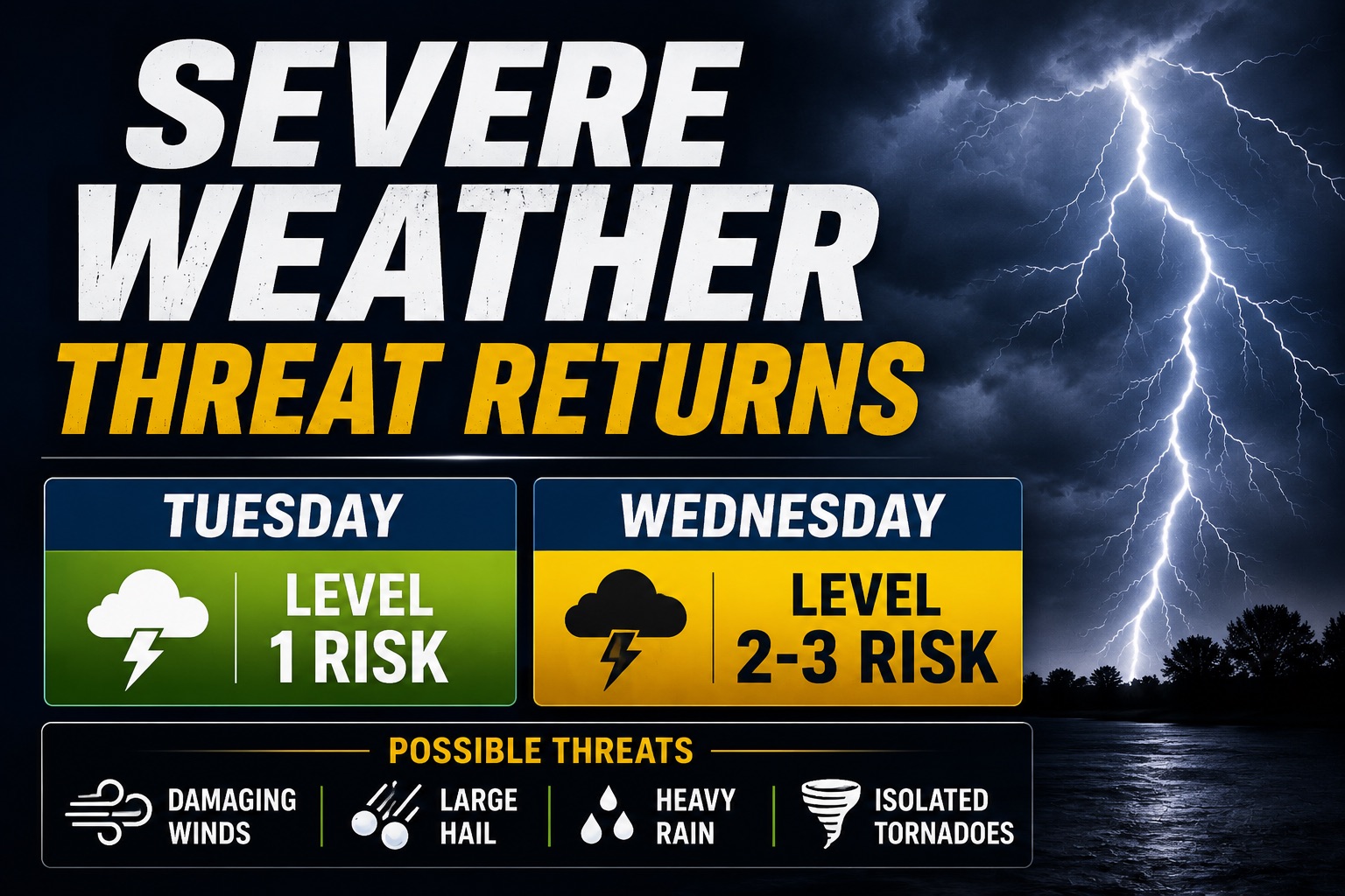
Forecasters say a few storms could become strong enough to produce damaging wind gusts, hail, heavy rainfall and isolated severe weather. While Tuesday's threat appears limited, residents are encouraged to monitor forecasts as conditions develop.
Greater concern is focused on Wednesday and Wednesday night.
The Storm Prediction Center has already highlighted much of Indiana for severe weather potential as a stronger storm system moves into the Great Lakes. Forecasters say the setup could support multiple types of severe weather, including damaging winds, large hail, torrential rainfall and isolated tornadoes.
Current forecast guidance suggests thunderstorms could organize into a larger line of storms Wednesday afternoon and evening before sweeping across the region overnight.
The timing is notable because many residents are still cleaning up from Thursday night's storms, which produced a confirmed EF-1 tornado in LaGrange and Steuben counties and left thousands without power across northern Indiana and southern Michigan.
Forecasters stress that the exact timing, location and severity of Wednesday's storms remain uncertain and could change over the next several days.
Residents are encouraged to review severe weather plans now and make sure they have multiple ways to receive watches and warnings, especially if storms develop after dark.